
What We’re Trying to Protect in WashCo
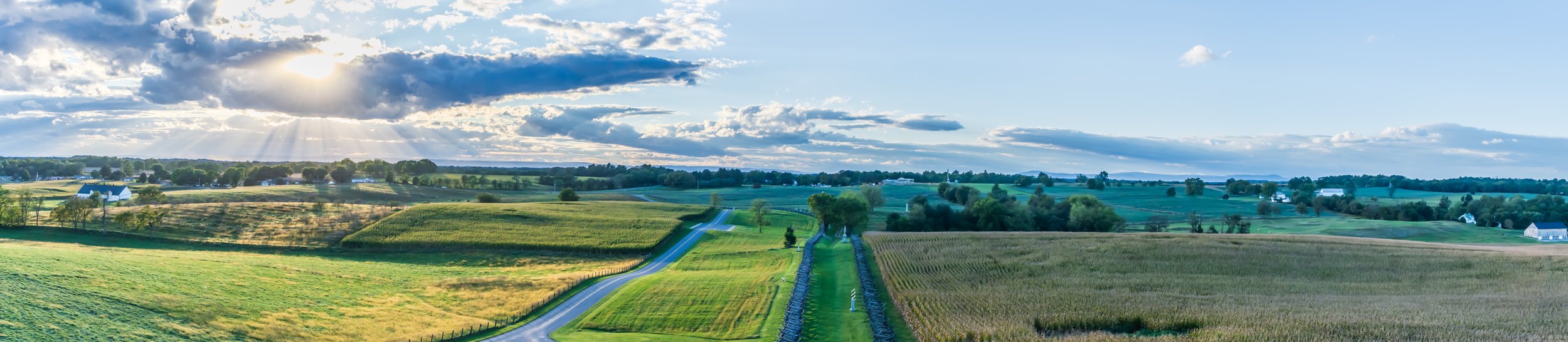
Washington County is changing fast. Warehouses are going up, housing is spreading, and a lot of land that used to be fields, woods, and floodplain edges is getting graded, filled, and paved. What makes that hit harder here is what this county actually is. WashCo sits on limestone valleys and karst ground, cut through by Antietam Creek, Beaver Creek, the Conococheague, and dozens of smaller runs that still carry life through the middle of development pressure. These waters and soils built some of the richest farmland in Maryland, but they also support pockets of native habitat that don’t exist the same way in other parts of the state.
A lot of what’s still alive in this county survives in fragments along these waterways and on thin, rocky ground over limestone. Floodplain edges along Antietam and Beaver Creek. Spring-fed seeps that stay wet when everything else dries out. Rocky slopes and old quarry edges where the soil is too thin for row crops but just enough for specialized native plants to hang on. These aren’t places most people think of as “habitat.” They’re the spaces people call messy, brushy, or wasted. They’re also where a lot of WashCo’s remaining biodiversity is hiding.
When these fragments disappear, the loss doesn’t look dramatic. The land still looks green. The creek still flows. But the native plants that hold the system together vanish first. Then the insects that rely on them stop showing up. Then the birds that feed on those insects disappear from those stretches of creek and field edge. The food web collapses quietly. Most people never notice because the change is gradual and spread out across dozens of small projects instead of one big, obvious clearcut.
Wild WashCo started because we were tired of watching that happen without a record of what was there before. We’re a small local crew spending time along Antietam, Beaver Creek, the Conococheague, and the overlooked edges in between — walking floodplains, limestone slopes, rocky fill areas near old quarry land, and the thin green strips between development. We document native plants, wildlife, and the habitats they’re still surviving in, not because these places are pristine, but because they’re vulnerable.
This page exists to document what’s still here across Washington County, not just in protected parks or “nice” nature spots. We focus on the messy edges because that’s where development pressure shows up first, especially on limestone ground that’s easy to grade and close to roads and utilities. Once those edges are gone, the species that depended on them don’t move somewhere else. They disappear from the county.
A big part of this work is just learning to see what’s already here. Once you know how to recognize native plants in limestone soils, you start seeing how rare they’ve become outside of preserves. Once you learn which insects and birds rely on those plants, the loss stops feeling abstract. You start noticing what’s missing from places that still look “natural” on the surface.
Wild WashCo is our field log for Washington County. We’re documenting what’s still alive in the limestone valleys, along Antietam and Beaver Creek, and in the overlooked corners that don’t make it into glossy conservation photos. The goal isn’t to romanticize the past. It’s to make what’s here visible now, before it gets quietly erased.
If you live in WashCo, you’re already walking past this every day. The creek behind your neighborhood, the field edge near your commute, the rocky slope near an old quarry — those places are part of the county’s living system whether we acknowledge them or not. Once you start noticing what lives there, it gets a lot harder to accept how easily it’s being paved over without anyone even knowing what was lost.